Torn between a canal home and a bayfront address in Royal Harbor? You’re not alone. Both offer true Naples waterfront living with boat access, scenic water, and an effortless indoor-outdoor lifestyle. In this guide, you’ll compare day-to-day differences, learn what to verify before you buy, and see which setting best fits your boating and lifestyle goals. Let’s dive in.
Royal Harbor at a glance
Royal Harbor sits on the east side of Naples Bay in Collier County. Most homes are on canals or directly on the bay, with direct routes out to the Gulf via Naples Bay and Gordon Pass. Many routes from Royal Harbor do not require navigating fixed low bridges, but you should always verify your exact path on official charts and posted signs. For navigation context and local harbor descriptions, consult the U.S. Coast Pilot for this area from NOAA’s Office of Coast Survey.
Local tides in Naples Bay are modest but matter for draft-sensitive boats. NOAA’s tide station at Naples Pier is a common reference used in local planning documents, and channel depths at the inlet can shape how deep a vessel can run at low water. Before you buy, confirm the mean low water depth at the dock and along your planned transit route.
Royal Harbor is part of a larger estuarine system. Agencies monitor water quality, seagrass, and mangroves across Naples Bay, which can influence permitting, dredging, and best practices for waterfront care.
- Read the NOAA harbor overview: U.S. Coast Pilot 5, Chapter 4
- See the tide-gauge reference noted in the Rookery Bay plan: Rookery Bay NERR Management Plan (Naples Pier station context)
- Learn about Naples Bay’s estuarine context: SFWMD evaluation of Naples Bay
Canal vs. bayfront: what changes day to day
Views and daylight
- Bayfront typically delivers wide, open-water views across Naples Bay and often westward sunsets. Fewer immediate obstructions mean a grander panorama and more expansive light.
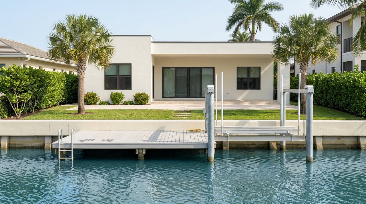
- Canal-front feels more intimate. You’ll enjoy water just beyond the lanai and a marina-like vibe, though neighboring docks and boats sit closer. Wider main canals feel more open than narrow finger canals.
Boating experience
- Bayfront minimizes transit time and offers easier turning room right off the dock. If you run a larger or deeper-draft vessel, that extra maneuvering space and a short hop into open water can be a daily luxury.
- Canal-front routes vary. Finger canals can favor smaller center consoles and runabouts, while wider main canals accommodate larger yachts. Always verify usable depth and turning radius for your specific vessel, and consider a marine survey. For local navigation context, review a practical boating guide to Naples and Gordon Pass.
Privacy, activity, and noise
- Bayfront brings broad views and a front-row seat to Naples Bay activity. Portions of the bay operate under idle-speed and no-wake rules, which can help moderate noise and wakes. You’ll see more traffic at a distance, with occasional wake energy.
- Canal-front is often calmer for daily boating conditions. The tradeoff is closer proximity to neighboring docks, which can reduce visual privacy. Wakes from passing boats may reflect along narrower canals depending on geometry.
Learn about local boating speed zones inside the city: City of Naples waterway regulations.
Exposure and surge risk
- Bayfront parcels absorb more open-water wind and wave energy. During severe weather, they can see higher dynamic forces at the seawall. Flood zone, finished-floor elevation, and seawall condition are critical.
- Canal-front is typically more sheltered day to day, yet still influenced by tides and storm surge. Surge can propagate inland along canals, and low-lying areas can back-water during major events. Use current flood maps and elevation certificates to understand risk at the address.
See Collier County’s flood resources and DFIRM updates: Collier County Floodplain Management. For long-term planning, county vulnerability studies project measurable sea-level rise by mid-century that can affect seawall heights and nuisance high-tide flooding. Review the county’s planning reference: Collier County Vulnerability Assessment (draft).
Maintenance, docks, seawalls, and permits
Waterfront living relies on seawalls, docks, and often boat lifts. These structures need periodic service and, eventually, replacement. During due diligence, ask for documented repairs, service records, and as-built drawings where available.
Expect multi-agency permitting for marine construction. Depending on scope, you may need city or county approvals, Florida DEP Environmental Resource Permitting, and sometimes U.S. Army Corps review. Start with DEP’s Southwest District for guidance and confirm property-specific permit history.
- Start here for coastal permitting: Florida DEP Southwest District Permitting
Insurance, lending, and regulatory context
Collier County’s updated digital flood maps took effect in early 2024 and feed directly into lender and NFIP flood-insurance requirements. Ask for the current FEMA panel and an Elevation Certificate if the home is in a Special Flood Hazard Area. Remember that flood insurance is separate from wind or hurricane coverage, and both impact ownership costs.
- Learn about DFIRM, certificates, and local contacts: Collier County Floodplain Management
Who fits where: a quick match guide
- Prioritize the shortest run to the Gulf, open-water views, and bigger boats: choose bayfront or a wide main canal.
- Prefer calmer daily conditions and often a more approachable price per waterfront foot: consider finger or sheltered canals, then confirm depth and turning room.
- Value privacy above all: look at cul-de-sac finger lots with thoughtful landscape buffers, understanding neighbors are closer on canals.
Every lot is unique. Width, orientation, dock quality, and view corridor can outweigh a simple “canal vs. bayfront” label.
What to verify before you buy
Use this checklist to streamline due diligence and reduce surprises.
Key documents to request
- Permit history for the dock, boat lift, and seawall, plus any dredging or in-water work. Confirm local permits and check with the Florida DEP if the work involved submerged lands or required an ERP. See Florida DEP Southwest District Permitting.
- Elevation Certificate and the current FEMA/DFIRM flood map panel for the address. Details and contacts: Collier County Floodplain Management.
- Recent marine survey or piling and deck inspection, along with invoices for lift, electrical, and seawall repairs.
- As-built drawings and final inspections or Certificates of Completion for waterfront structures, where available.
- Water-depth soundings at the dock face and along the intended route to Naples Bay at mean low water. If you run a tall vessel, confirm any overhead powerline or cable clearances. For local navigation context, see this Naples boating guide.
Smart questions to ask on a showing
- What is the mean low water depth at the dock and along the direct route to Naples Bay? Request a recent sounding.
- Are there finalized permits and inspections on record for the seawall, dock, and lift? Get copies.
- Who controls the submerged land in front of the property, and is there a state consent or lease on file if required?
- Has the seawall or dock needed emergency or post-storm repairs in the last 10 years? Ask for invoices and contractor contacts.
- What is the current FEMA flood zone for the address, and is there a recent Elevation Certificate? Have DFIRM updates changed the designation?
- Is the path to the Gulf via Naples Bay free of fixed low bridges for your vessel height? Confirm on official charts and posted markers. For navigation references, review NOAA’s Coast Pilot.
Contingencies worth adding
- A structural marine survey of piles, decking, lifts, and electrical.
- A seawall or coastal-engineer visual assessment, especially if the wall shows bowing, scalloping, or age.
- Depth verification at mean low water and written confirmation of safe turning room for your intended vessel.
- Clear title and permit verification for all waterfront structures.
Cost and market context
Values in Royal Harbor vary widely. Frontage type, lot width, orientation, water depth, and the age and quality of the home and waterfront improvements all influence pricing. Market measures shift month to month, so ask for a current neighborhood snapshot and recent comparable sales tailored to your preferred lot type and boating needs.
The bottom line
You cannot go wrong choosing Royal Harbor for true Naples waterfront living. If you want sweeping bay views and the quickest run time, focus on bayfront or wider main canals. If you prefer sheltered water and a more intimate setting, the right canal lot can be your sweet spot. Either way, verify depth, permits, and flood details so your home fits your vessel, your lifestyle, and your long-term plans.
If you’re ready to compare specific lots, schedule a depth check, or review permitting and flood details before you write an offer, connect with Susan Barreiro for boutique, concierge-level guidance backed by local expertise.
FAQs
What’s the core difference between canal and bayfront in Royal Harbor?
- Bayfront offers wide open-water views and the shortest run into Naples Bay, while canal-front delivers more sheltered conditions and a closer, marina-style feel.
Are there fixed low bridges from Royal Harbor to the Gulf of Mexico?
- Many routes are considered “no bridge,” but always confirm your exact path and overhead clearances using official resources like NOAA’s Coast Pilot.
How do tides affect boating depth near Naples Bay?
- Tides are modest but matter for draft; confirm mean low water depth at your dock and along your route. The local tide reference at Naples Pier is noted in the Rookery Bay NERR plan.
What permits are needed for a new dock or seawall in Naples?
- Marine work typically involves local approvals and Florida DEP Environmental Resource Permitting, with possible federal review. Start with Florida DEP Southwest District Permitting.
How do Collier County flood maps impact insurance for Royal Harbor homes?
- Updated DFIRM panels influence lender requirements and NFIP eligibility. Request the current FEMA panel and an Elevation Certificate; see Collier County Floodplain Management.
What long-term sea-level considerations should I plan for on a waterfront lot?
- County planning references project measurable sea-level rise by mid-century, which can affect seawall height and nuisance high-tide flooding. Review the Collier County Vulnerability Assessment (draft).